PROTHEGO: monitoring European cultural heritage at risk of volcanic eruptions
Southern Europe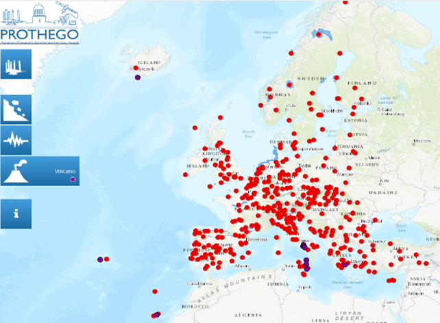
Lead
Main hazard(s)
Disaster Risk Management phase(s)
Type(s) of measure(s)
Background
The FP7 PROTHEGO (PROTection of European Cultural HEritage from GeO – hazards) project, Led by the Italian Institute for Environmental Protection and Research, and in collaboration with NERC British Geological Survey, Geological and Mining Institute of Spain, University of Milano-Bicocca and Cyprus University of Technology, applied InSAR techniques to monitor monuments and sites that are potentially unstable due to landslides, sinkholes, settlement, subsidence, active tectonics as well as structural deformation.
The analysis includes 450 sites on the UNESCO World Heritage List in Europe, of which 11 are at risk of volcanic eruption (one in Iceland, one in Portugal, one in Spain, one in Greece and seven in Italy). All of them are displayed on a map where additional information on their UNESCO heritage site (and their criteria), their potential hazards and available satellite data is made available to the public.
Sources
Funded in the framework of the Joint, under ERA-NET Plus and the Seventh Framework Programme (FP7) of the European Commission, the project PROTHEGO aims to make an innovative contribution towards the analysis of geohazards in areas of cultural heritage in Europe.
More information on PROTHEGO can be found here: http://www.prothego.eu/home.html
And the Map viewer accessed here: http://mapapps2.bgs.ac.uk/prothego/index.html


 – pixabay by Michelle Maria")


