Local historical knowledge to inform climate stress tests in the Netherlands
The Netherlands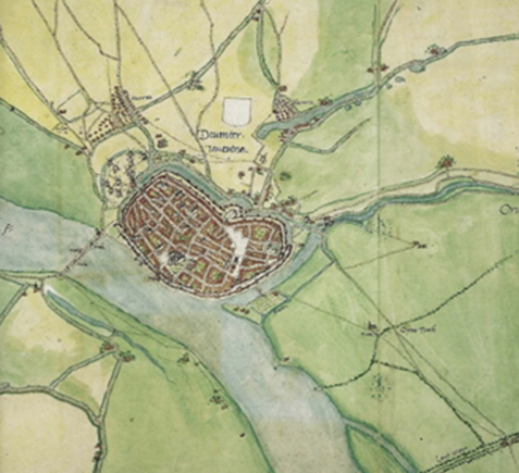
Lead
Main hazard(s)
Disaster Risk Management phase(s)
Type(s) of measure(s)
Background
Located in the North-West of Europe, the Netherlands form part of the European River Delta, linked to major European rivers (e.g. the Rhine, Meuse and Scheldt). Flanked by the Northern Sea, the country has 1,275 km of coastline [i] with 26% of the national territory lying below sea level. All these geographical and climatic features, along with high levels of urban density and climate change, make the Netherlands especially vulnerable to flooding [ii].
Dutch cities have been repeatedly exposed to flooding events over history, having to learn to adapt. Recent research [iii] indicates that some of these cities have had in place for some time an integrated policy connecting urban water, a water board administration and even engineering projects that enabled safe living conditions. The current case study explores how Dutch cities are integrating historical knowledge to advance adaptation efforts in the face of current and future climate-related hazards.
[i] Policy Research Corporation (2006). The economics of climate change adaptation in EU coastal areas. Country overview and assessment – The Netherlands. Study done on behalf of the European Commission. Available here: https://ec.europa.eu/maritimeaffairs/sites/maritimeaffairs/files/docs/body/report_en.pdf
[ii] van den Brink, M., Meijerink, S., Termeer, C., & Gupta, J. (2014). Climate-proof planning for flood-prone areas: assessing the adaptive capacity of planning institutions in the Netherlands. Regional environmental change, 14(3), 981-995.
[iii] Kosian, M.C. & van Lanen R., (2019). The importance of history for Modern Climate Adaptation Strategies. Proceedings of the 22nd International Conference on Cultural Heritage and New Technologies 2017.CHNT 22, 2017 (Vienna 2019). http://www.chnt.at/proceedings-chnt-22/ ISBN 978-3-200-06160-6
Sources
https://www.chnt.at/wp-content/uploads/eBook_CHNT23_Kosian.pdf
https://www.academia.edu/38645950/The_Importance_of_History_for_Modern_Climate_Adaptation_Strategies
Interview with Menne Kosian, Spatial Analysis Researcher at the Landscape Department at the Cultural Heritage Agency of the Netherlands
The Cultural Heritage Agency
The Cultural Heritage Agency of the Netherlands is responsible for executing a part of the Dutch government’s policy on shared heritage by means of its Shared Cultural Heritage Programme, and works on three main topical areas: Maritime Archaeology, Built Environment and Collections. It works together with ten partner countries. To learn more about the Cultural Heritage Agency, visit: https://english.cultureelerfgoed.nl/
Detailed description
In 2018, the National Government launched the Delta Plan on Spatial Adaptation (DeltaplanRuimtelijkeadaptatie) in order to render the Netherlands climate proof and water-resilient. The policy calls for cities to perform climate stress tests, which are based on GIS models to assess which areas and assets in a city have higher risks of flooding or heat stress, based on hydrological, geological and geophysical variables. Following these models, the local authorities can address the risks with specific adaptation policies. However, they only take into account present-day surface aspects, neglecting historical information.
The Cultural Heritage Agency of the Netherlands (RCE) aims to help municipal departments integrate traditional knowledge(e.g. construction techniques and historical reasons for certain construction choices) into their stress tests by looking at aspects such as historical water systems, natural landscape dynamics, climate change, urban morphology and traditional measures and knowledge of flood protection. The evolution of such aspects can be extracted by analysing historical maps such as the ‘Waterstaatskaarten’ (a series of 1:50,000 scale maps regularly updated from 1865 onwards providing a complete descriptive overview on polder levels, water management systems and hydrological engineering works), which are then digitalised and contrasted with the modern GIS models generated as part of the climate stress tests. The Agency offers support to municipalities by providing historical maps, generating new GIS data and advisingon how to perform comparative analysis to identify gaps and existing solutions. Capacity building and training (in the form of workshops, lectures and consultations) is also delivered by RCE’s experts as per the municipalities’ request, without additional costs.
Main outcomes and highlights
- Cities such as Kampen and Dordrecht have so far successfully integrated historical knowledge into the climate stress tests.
- The initiative has contributed to reinforcing the cultural identity of the municipalities, resulting in adaptation policies that are tailored to their local conditions and existing heritage. Such respect for the local character has contributed to win residents’ support.
- All the data generated is made free and accessible through the RCE’s website.
- The initiative has contributed to establishing a more integrated approach towards adaptation, bringing together different departments that are generally not used to cooperate, such as the sewage, the archaeological departments and even the municipal police (e.g. in Dordrecht).
Sucess factors
- The Netherlands has an extensive repository of historical maps (including city maps, paleo-geographical maps and engineering plans) conserved in the Water Boards, which are still operative and make the access of such documents easy.
- Municipalities have traditionally considered the protection of cultural heritage as an expensive luxury. With this initiative, cultural heritage is presented as a solution that can be integrated in other sectors and policies (for instance, adaptation and resilience), and therefore can be covered by a broader range of funding sources.
Lessons learned
- Before applying the step-by-step guidance, people working in cities need to be aware of the fact that they are already flood-adaptive and they have valid systems which have been systematically tested by history. This is important in terms of securing political and social buy-in early in the process.
- The approach towards adaptation varies enormously among different municipalities based on their specific characteristics and ways of operating. In some cases, different departments are already cooperating closely, in some others there are silos; in these last cases, broader efforts are needed in terms of bringing the different departments together.


